Ricochet is the best place on the internet to discuss the issues of the day, either through commenting on posts or writing your own for our active and dynamic community in a fully moderated environment. In addition, the Ricochet Audio Network offers over 50 original podcasts with new episodes released every day.
 Share Your Local Traffic Nightmares
There is a certain kind of traffic intersection in which the design transcends mere incompetence and inattention and enters the realm of genuine malice. These atrocities don’t just inconvenience or endanger commuters and pedestrians, but embody active hatred and threat against them. For example, our own Fred Cole recently brought to my attention this horror show, which is — blessedly — being renovated but, in the interests of gaining a certain kind of dark knowledge, I propose the following contest: Let’s see who among us has the worst traffic intersection in their area.
For my own local example, I refer you to Neponset Circle. Located at the extreme southern edge of Boston, this spiteful, vindictive geometric sprawl links no fewer than five different roads, three of which are center-divided, and one of which is a half-mile-long bridge. Add to this two — two! — 180-degree turnarounds that are not part of the circle itself, multiple shortcuts between some of the roads, and a northbound-only freeway entrance (sorry, southbound drivers!), and you’ve got a sense of it. Oh, did I mention that it’s also crawling with traffic signals? Because it’s totally crawling with traffic signals.
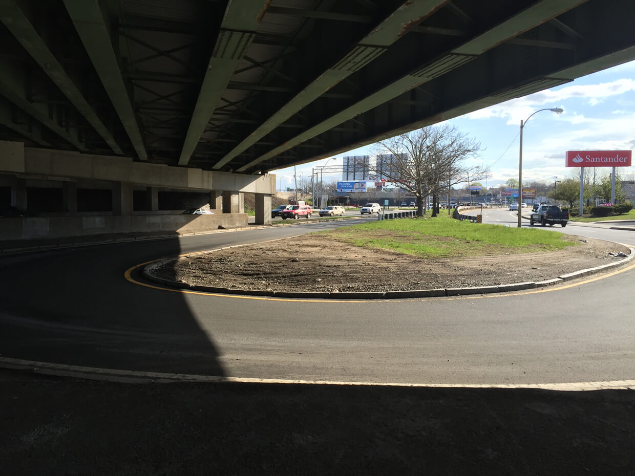
One of the 180-degree turnarounds that is not part of the main circle (which was behind me when I took this photograph).
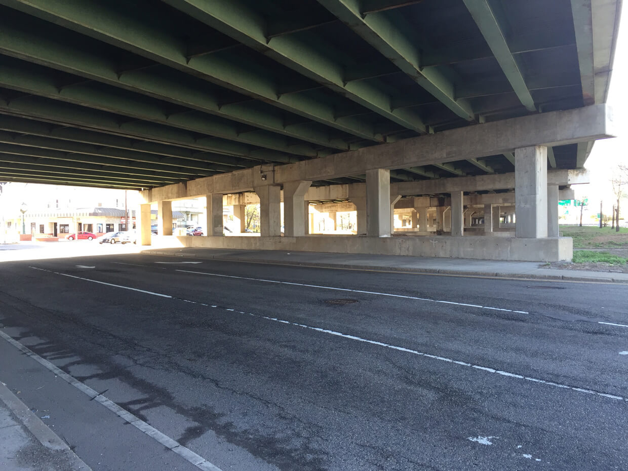
I-93 above. And yes, this is part of a “circle.”
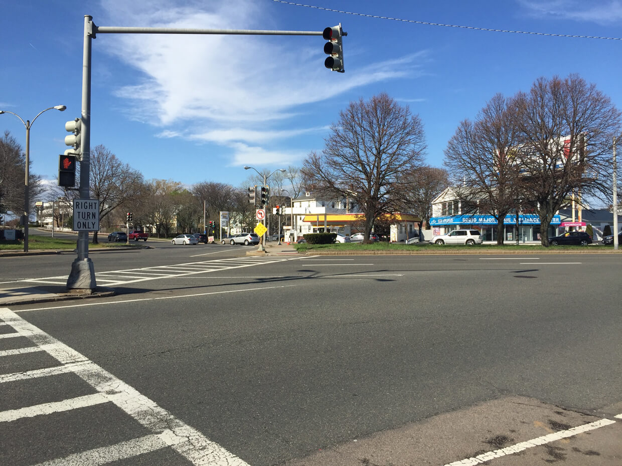
I count eight traffic signals in this picture. Gallivan Boulevard is to the left, Neponset Avenue to the right, and the northbound exit to William T Morrissey Boulevard is straight ahead, in the distance. So, yes, this is basically a third of the whole mess.
So Ricochet, hit me with your best shot.
Published in General
There is an intersection in North Charleston where the drug traffic is terrible.
The lack of traffic is one of the reasons that I live in Montana. (No point. Just gloating.)
Many of the Washington, DC traffic circles are nightmares. Washington Circle and Dupont Circle are particularly fun to navigate.
They are doing some work in our area and putting in a new bridge (maybe). Part of this endeavor is to replace a standard intersection and to replace it with a roundabout. This is supposed to increase traffic throughput and maybe would if it was not for its daily wrecks and weekly flipped semis. The government’s answer to this issue was to create this PDF on how to drive the roundabout.
http://eastendcrossing.com/wp-content/uploads/Brochure_How-to-Drive-a-Roundabout.pdf
They have also lowered the normal speed of this road from 55 down to 20 to resolve this issue and get better “throughput”. I am not sure about “throughput” but they have managed to get a large portion of the people in the area to avoid the roundabout and drive through alternate routes and neighborhoods.
I assume they will resolve the issue and go back to a traditional interchange once a high profile death occurs. Sad that it will take that.
I know them both well. They are terrible.
DC is the only place I’ve ever seen traffic circles (which supposedly alleviate the need for traffic signals) with traffic signals. Even walking through them is ridiculously complex.
Heading into Atlanta from the north are two interstate highways (I-75 & I-85) and a limited access state highway (GA 400 aka the Alpharetta Autobahn). GA 400 South goes from a 4 lane highway down to one lane to merge onto 1-85 just north of where I-85 merges with I-75 to create the Downtown Connector. This has the effect of funneling 12 or more lanes of traffic into 5 in the space of just a mile or so. Not to mention a major east-west interstate (I-20) intersects with the connector another couple of miles to the south.
There is a strip of highway in the middle of San Antonio which (iirc) is about 7 different highways. When all the lanes split apart you either have to be in the right one or you’re in for a lovely trip to the barrio.
Easton, PA has a traffic circle with lights (you can see them in the photo if you look close). If not for the monument in the center, it would probably be a four way stop as traffic isn’t too heavy. The current configuration is confusing and somewhat dangerous. They’d be better off without the signals IF drivers would maintain reasonable speeds in the circle.
Oy.
Pix or it didn’t happen!
We lived in MA for 2.5 years, and everywhere we drove was a nightmare. Back then, there was always construction on the Mass Pike.
There has to be a reason to flag this – surely this kind of mockery isn’t in the spirit of the CoC!
Oh well, at least I don’t live in Houston.
The highway exit nearest my old apartment in Duluth had you cross a divided highway, then come to a complete stop at a four-way intersection ~125 feet away while going down a fairly steep grade. In decent weather, it was bad; in a blizzard… well, thank God I had those super-low gears on my Jeep.
The fact that it brought you to the intersection of 4th St. and 4th Ave. only made it better.
Designers out here are fond of the yield on green for left turns. They didn’t account for population growth or seasons when we’re bustling with tourists, Canadian shoppers, outlying residents making supply runs, etc. It is stressful enough to wait at a light and never have an opportunity to turn left. (Fortunately, many lights include the arrow, too–but not all.)
But the worst intersection is at a busy shopping center where, when you get a green light where it’s permissible to turn left, you can’t see the lane of oncoming traffic. It is hidden by the line of cars in the opposite turn lane. So every car wanting to turn left has to creep into the intersection and try to get a peek at that oncoming line of cars. Even if the space at the front of that line is empty, it’s no guarantee that there isn’t some driver further down that is about to throttle his way into the intersection.
There’s this lovely little intersection West of Hershey PA. My dad used to call it “fifteen lights” for obvious reasons
https://www.google.com/maps/@40.2615476,-76.7440011,3a,56.1y,294.58h,78.36t/data=!3m6!1e1!3m4!1sEdbtkXFQg6vby5iWqa2XkQ!2e0!7i13312!8i6656
Vey
That’s terrifying. I’m talking shoggoths-down-the-5000-steps-level scary.
Rochester, NY used to have a place where two expressways crossed that was called The Can of Worms. Since reconfigured, but the old mess has its own Wikipedia page:
https://en.wikipedia.org/wiki/Can_of_Worms_(interchange)
They didn’t have room for a proper cloverleaf, so they just had a stretch where you had to merge left or right depending on which route you were on.
You know, that’s probably the most apt description I’ve heard. I’m pretty sure the civil engineer designed it according to the visions of cyclopean alien vistas he beheld after ingesting the black lotus.
I’ve driven through that!
I wondered why they didn’t just make one big circle.
I think the Druids had a hand in that. “Make 6 sunwise turns, in a sunwise turn, about the Great Crossroads…”
Having 5 points I should think it would be called Satan’s Roundabout.
It’s not a traffic nightmare completely, but some jackwagon went around me the other day to blow through a yellow/red light because I was actually going to stop at it.
Here in Austin, we’ve been following this strategy since the early 80’s, if not before:
It hasn’t worked.
No terrible intersections come to mind, just terrible traffic, especially for a city our size.
I DREAM of having Houston’s throughput capacity
::bugeyes::
My recollection of driving through Austin (mostly over after I discovered the upper decks of 35) is that people sped up going into Austin so as to get out of it as soon as possible. This action was, not surprisingly, counter productive.
They need to get into the idea of taking SH 130 and paying its toll as a bypass.
While I was growing up in Chicago, there was something called Lower Wacker Drive. It was a covered highway which ran along the river. Driving it required you to dodge a forest of randomly-placed concrete pillars in almost total darkness. I understand it’s since been yuppiefied, but I hope they haven’t removed the favorite traffic signs of my youth: Wacker Lower Level.